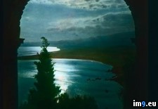
Pict. Carmel, California - panoramic view of the coast (1915-1920).1379 (#California #Coast #Panoramic #Carmel)Pict. 799×766 px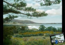 Pict. Taormina - panoramic view of the coast near Taormina, under moonlight (1925-1938).3548 (#Coast #Panoramic #Moonlight #Taormina)Pict. 799×747 px
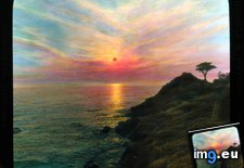
 Pict. California - sunset on the Pacific Ocean from the California coast (1915-1920).1385 (#California #Sunset #Ocean #Coast #Pacific)Pict. 799×743 px
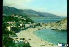
 Pict. Sicily - Sicilian coast at Taormina (1919-1938).3485 (#Coast #Sicily #Taormina #Sicilian)Pict. 799×748 px
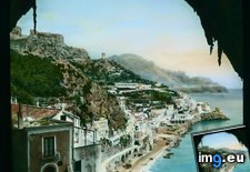
 Pict. Amalfi - view of the coast, from the Grotto of San Cristoforo (1919-1938).2358 (#San #Coast #Amalfi #Grotto #Cristoforo)Pict. 799×747 px
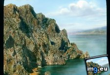
 Pict. Capri - rocky coast below the charterhouse (1919-1938).2486 (#Coast #Capri #Rocky #Charterhouse)Pict. 799×748 px
 Pict. [Pics] New baby volcano erupts off coast of Japan. (#Baby #Japan #Coast #Volcano #Erupts)Pict. 634×939 px
![[Pics] New baby volcano erupts off coast of Japan. (#Baby #Japan #Coast #Volcano #Erupts) - 125 KB Tags: baby, coast, erupts, japan, volcano (Pict. in My r/PICS favs)](https://t.im9.eu/pics-new-baby-volcano-erupts-off-coast-of-japan.jpg) Pict. Taormina - panoramic view of the coast near Taormina (1925-1938).3546 (#Coast #Panoramic #Taormina)Pict. 799×748 px
Pict. Taormina - panoramic view of the coast near Taormina (1925-1938).3546 (#Coast #Panoramic #Taormina)Pict. 799×748 px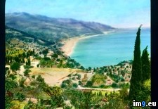 Pict. Rapallo - aerial view of Rapallo on the Ligurian coast (1919-1938).3176 (#Coast #Aerial #Rapallo #Ligurian)Pict. 799×748 px
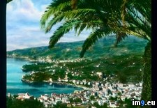 Pict. Ravello - aerial view of the Amalfi coast, from Ravello (1919-1938).3162 (#Coast #Aerial #Amalfi #Ravello)Pict. 799×748 px
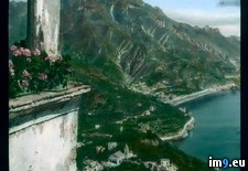 Pict. County Antrim - road along the Antrim coast (1932-1935).4330 (#Road #County #Coast #Antrim)Pict. 799×746 px
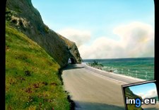 Pict. Amalfi - cove on the Amalfi coast road (1919-1938).2361 (#Road #Coast #Amalfi #Cove)Pict. 799×747 px
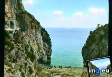 Pict. Sicily - Sicilian coast (1919-1938).3484 (#Coast #Sicily #Sicilian)Pict. 799×748 px
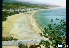 Pict. Amalfi - Amalfi coast at sunset (1919-1938).2364 (#Sunset #Coast #Amalfi)Pict. 799×747 px
 Pict. Amalfi - Amalfi coast at sunset (1919-1938).2363 (#Sunset #Coast #Amalfi)Pict. 799×747 px
 Pict. [Mapporn] Alternate United States West Coast, loosely based on current partition proposals [318 x 507] (#States #United #West #Alternate #Partition #Proposals #Loosely)Pict. 318×507 px
![[Mapporn] Alternate United States West Coast, loosely based on current partition proposals [318 x 507] (#States #United #West #Alternate #Partition #Proposals #Loosely) - 22 KB Tags: alternate, based, coast, current, loosely, partition, proposals, states, united, west (Pict. in My r/MAPS favs)](https://t.im9.eu/mapporn-alternate-united-states-west-coast-loosely-based-on-current-partition-proposals-318-x-507.jpg) Pict. [Mapporn] The bombardment of Ft. Jackson [3658X2358] Part of Coast Survey's Civil War Collection 'Charting a More Perfect Union' (#Collection #Part #Perfect #Survey #Jackson #Civil #Bombardment)Pict. 3658×2358 px
Pict. [Mapporn] The bombardment of Ft. Jackson [3658X2358] Part of Coast Survey's Civil War Collection 'Charting a More Perfect Union' (#Collection #Part #Perfect #Survey #Jackson #Civil #Bombardment)Pict. 3658×2358 px![[Mapporn] The bombardment of Ft. Jackson [3658X2358] Part of Coast Survey's Civil War Collection 'Charting a More Perfect Union' (#Collection #Part #Perfect #Survey #Jackson #Civil #Bombardment) - 1009 KB Tags: bombardment, civil, coast, collection, jackson, part, perfect, survey, union, war (Pict. in My r/MAPS favs)](https://t.im9.eu/mapporn-the-bombardment-of-ft-jackson-3658x2358-part-of-coast-survey-s-civil-war-collection-charting-a-more-perfect-union.jpg) Pict. [Mapporn] Where you'd end up by traveling due north from the Arctic coast (then reaching the north pole) and continuing south al (#End #South #North #Arctic #Traveling #Reaching #Continuing)Pict. 4176×1649 px
Pict. [Mapporn] Where you'd end up by traveling due north from the Arctic coast (then reaching the north pole) and continuing south al (#End #South #North #Arctic #Traveling #Reaching #Continuing)Pict. 4176×1649 px![[Mapporn] Where you'd end up by traveling due north from the Arctic coast (then reaching the north pole) and continuing south al (#End #South #North #Arctic #Traveling #Reaching #Continuing) - 504 KB Tags: arctic, coast, continuing, due, end, north, pole, reaching, south, traveling (Pict. in My r/MAPS favs)](https://t.im9.eu/mapporn-where-you-d-end-up-by-traveling-due-north-from-the-arctic-coast-then-reaching-the-north-pole-and-continuing-south-along-the-opposing-longitude-until-reaching-land-oc-4176x1649.jpg) Pict. [Mapporn] Manuscript Japanese Chart -southern coast to Ogasawara islands(?) 2730 x 3666 (#Japanese #Coast #Chart #Manuscript #Ogasawara)Pict. 2730×3666 px
Pict. [Mapporn] Manuscript Japanese Chart -southern coast to Ogasawara islands(?) 2730 x 3666 (#Japanese #Coast #Chart #Manuscript #Ogasawara)Pict. 2730×3666 px![[Mapporn] Manuscript Japanese Chart -southern coast to Ogasawara islands(?) 2730 x 3666 (#Japanese #Coast #Chart #Manuscript #Ogasawara) - 992 KB Tags: chart, coast, islands, japanese, manuscript, ogasawara, southern (Pict. in My r/MAPS favs)](https://t.im9.eu/mapporn-manuscript-japanese-chart-southern-coast-to-ogasawara-islands-2730-x-3666.jpg) Pict. [Mapporn] The world's poles of inaccessibility- the farthest points from the coast on each continent [1278x619] (#World #Coast #Continent #Farthest #Inaccessibility)Pict. 1278×619 px
Pict. [Mapporn] The world's poles of inaccessibility- the farthest points from the coast on each continent [1278x619] (#World #Coast #Continent #Farthest #Inaccessibility)Pict. 1278×619 px![[Mapporn] The world's poles of inaccessibility- the farthest points from the coast on each continent [1278x619] (#World #Coast #Continent #Farthest #Inaccessibility) - 332 KB Tags: coast, continent, farthest, inaccessibility, points, poles, world (Pict. in My r/MAPS favs)](https://t.im9.eu/mapporn-the-world-s-poles-of-inaccessibility-the-farthest-points-from-the-coast-on-each-continent-1278x619.jpg) Pict. [Mapporn] San Francisco Gold Rush-era coast line vs. new land built on landfill [1000x898] (#San #Built #Line #Land #Era #Rush)Pict. 1000×898 px
Pict. [Mapporn] San Francisco Gold Rush-era coast line vs. new land built on landfill [1000x898] (#San #Built #Line #Land #Era #Rush)Pict. 1000×898 px![[Mapporn] San Francisco Gold Rush-era coast line vs. new land built on landfill [1000x898] (#San #Built #Line #Land #Era #Rush) - 167 KB Tags: built, coast, era, francisco, gold, land, line, rush, san (Pict. in My r/MAPS favs)](https://t.im9.eu/mapporn-san-francisco-gold-rush-era-coast-line-vs-new-land-built-on-landfill-1000x898.jpg) Pict. [Mapporn] Top Ivy League Schools and East Coast Cities [735x522] (#Top #League #Ivy #Schools #735x522)Pict. 735×522 px
Pict. [Mapporn] Top Ivy League Schools and East Coast Cities [735x522] (#Top #League #Ivy #Schools #735x522)Pict. 735×522 px![[Mapporn] Top Ivy League Schools and East Coast Cities [735x522] (#Top #League #Ivy #Schools #735x522) - 100 KB Tags: 735x522, cities, coast, east, ivy, league, schools, top (Pict. in My r/MAPS favs)](https://t.im9.eu/mapporn-top-ivy-league-schools-and-east-coast-cities-735x522.jpg) Pict. [Mapporn] U.S. Coast Guard Districts and Air Stations.[3000x2000] (#Air #Guard #Coast #3000x2000 #Districts #Stations)Pict. 3000×2096 px
Pict. [Mapporn] U.S. Coast Guard Districts and Air Stations.[3000x2000] (#Air #Guard #Coast #3000x2000 #Districts #Stations)Pict. 3000×2096 px![[Mapporn] U.S. Coast Guard Districts and Air Stations.[3000x2000] (#Air #Guard #Coast #3000x2000 #Districts #Stations) - 581 KB Tags: 3000x2000, air, coast, districts, guard, stations (Pict. in My r/MAPS favs)](https://t.im9.eu/mapporn-u-s-coast-guard-districts-and-air-stations-3000x2000.jpg) Pict. [Mapporn] Ship Traffic on Indonesian waters from the Indonesian Coast Guard Surveillance at May 27th 2015 at around 8:37 p.m. UT (#May #Guard #Traffic #Waters #Indonesian)Pict. 1275×713 px
Pict. [Mapporn] Ship Traffic on Indonesian waters from the Indonesian Coast Guard Surveillance at May 27th 2015 at around 8:37 p.m. UT (#May #Guard #Traffic #Waters #Indonesian)Pict. 1275×713 px![[Mapporn] Ship Traffic on Indonesian waters from the Indonesian Coast Guard Surveillance at May 27th 2015 at around 8:37 p.m. UT (#May #Guard #Traffic #Waters #Indonesian) - 247 KB Tags: coast, guard, indonesian, may, ship, traffic, waters (Pict. in My r/MAPS favs)](https://t.im9.eu/mapporn-ship-traffic-on-indonesian-waters-from-the-indonesian-coast-guard-surveillance-at-may-27th-2015-at-around-8-37-p-m-utc-07-00-1275x713.jpg)
★ 9395 pkt. ♥ 0 lubi ⬇ 6 zapisy
 Pict. Taormina - panoramic view of the coast near Taormina, under moonlight (1925-1938).3548 (#Coast #Panoramic #Moonlight #Taormina)Pict. 799×747 px
★ 9304 pkt. ♥ 0 lubi ⬇ 2 zapisy
 Pict. California - sunset on the Pacific Ocean from the California coast (1915-1920).1385 (#California #Sunset #Ocean #Coast #Pacific)Pict. 799×743 px
★ 9293 pkt. ♥ 0 lubi ⬇ 2 zapisy
 Pict. Sicily - Sicilian coast at Taormina (1919-1938).3485 (#Coast #Sicily #Taormina #Sicilian)Pict. 799×748 px
★ 9273 pkt. ♥ 0 lubi ⬇ 5 zapisy
 Pict. Amalfi - view of the coast, from the Grotto of San Cristoforo (1919-1938).2358 (#San #Coast #Amalfi #Grotto #Cristoforo)Pict. 799×747 px
★ 9210 pkt. ♥ 0 lubi ⬇ 2 zapisy
 Pict. Capri - rocky coast below the charterhouse (1919-1938).2486 (#Coast #Capri #Rocky #Charterhouse)Pict. 799×748 px
★ 9130 pkt. ♥ 0 lubi ⬇ 4 zapisy
 Pict. [Pics] New baby volcano erupts off coast of Japan. (#Baby #Japan #Coast #Volcano #Erupts)Pict. 634×939 px
★ 9069 pkt. ♥ 0 lubi ⬇ 8 zapisy
![[Pics] New baby volcano erupts off coast of Japan. (#Baby #Japan #Coast #Volcano #Erupts) - 125 KB Tags: baby, coast, erupts, japan, volcano (Pict. in My r/PICS favs)](https://t.im9.eu/pics-new-baby-volcano-erupts-off-coast-of-japan.jpg) Pict. Taormina - panoramic view of the coast near Taormina (1925-1938).3546 (#Coast #Panoramic #Taormina)Pict. 799×748 px
Pict. Taormina - panoramic view of the coast near Taormina (1925-1938).3546 (#Coast #Panoramic #Taormina)Pict. 799×748 px★ 8952 pkt. ♥ 0 lubi ⬇ 6 zapisy
 Pict. Rapallo - aerial view of Rapallo on the Ligurian coast (1919-1938).3176 (#Coast #Aerial #Rapallo #Ligurian)Pict. 799×748 px
★ 8914 pkt. ♥ 0 lubi ⬇ 1 zapisy
 Pict. Ravello - aerial view of the Amalfi coast, from Ravello (1919-1938).3162 (#Coast #Aerial #Amalfi #Ravello)Pict. 799×748 px
★ 8815 pkt. ♥ 0 lubi ⬇ 0 zapisy
 Pict. County Antrim - road along the Antrim coast (1932-1935).4330 (#Road #County #Coast #Antrim)Pict. 799×746 px
★ 8815 pkt. ♥ 0 lubi ⬇ 4 zapisy
 Pict. Amalfi - cove on the Amalfi coast road (1919-1938).2361 (#Road #Coast #Amalfi #Cove)Pict. 799×747 px
★ 8667 pkt. ♥ 0 lubi ⬇ 2 zapisy
 Pict. Sicily - Sicilian coast (1919-1938).3484 (#Coast #Sicily #Sicilian)Pict. 799×748 px
★ 8636 pkt. ♥ 0 lubi ⬇ 5 zapisy
 Pict. Amalfi - Amalfi coast at sunset (1919-1938).2364 (#Sunset #Coast #Amalfi)Pict. 799×747 px
★ 8349 pkt. ♥ 0 lubi ⬇ 2 zapisy
 Pict. Amalfi - Amalfi coast at sunset (1919-1938).2363 (#Sunset #Coast #Amalfi)Pict. 799×747 px
★ 8341 pkt. ♥ 0 lubi ⬇ 1 zapisy
 Pict. [Mapporn] Alternate United States West Coast, loosely based on current partition proposals [318 x 507] (#States #United #West #Alternate #Partition #Proposals #Loosely)Pict. 318×507 px
★ 7850 pkt. ♥ 0 lubi ⬇ 14 zapisy
![[Mapporn] Alternate United States West Coast, loosely based on current partition proposals [318 x 507] (#States #United #West #Alternate #Partition #Proposals #Loosely) - 22 KB Tags: alternate, based, coast, current, loosely, partition, proposals, states, united, west (Pict. in My r/MAPS favs)](https://t.im9.eu/mapporn-alternate-united-states-west-coast-loosely-based-on-current-partition-proposals-318-x-507.jpg) Pict. [Mapporn] The bombardment of Ft. Jackson [3658X2358] Part of Coast Survey's Civil War Collection 'Charting a More Perfect Union' (#Collection #Part #Perfect #Survey #Jackson #Civil #Bombardment)Pict. 3658×2358 px
Pict. [Mapporn] The bombardment of Ft. Jackson [3658X2358] Part of Coast Survey's Civil War Collection 'Charting a More Perfect Union' (#Collection #Part #Perfect #Survey #Jackson #Civil #Bombardment)Pict. 3658×2358 px★ 7383 pkt. ♥ 0 lubi ⬇ 6 zapisy
![[Mapporn] The bombardment of Ft. Jackson [3658X2358] Part of Coast Survey's Civil War Collection 'Charting a More Perfect Union' (#Collection #Part #Perfect #Survey #Jackson #Civil #Bombardment) - 1009 KB Tags: bombardment, civil, coast, collection, jackson, part, perfect, survey, union, war (Pict. in My r/MAPS favs)](https://t.im9.eu/mapporn-the-bombardment-of-ft-jackson-3658x2358-part-of-coast-survey-s-civil-war-collection-charting-a-more-perfect-union.jpg) Pict. [Mapporn] Where you'd end up by traveling due north from the Arctic coast (then reaching the north pole) and continuing south al (#End #South #North #Arctic #Traveling #Reaching #Continuing)Pict. 4176×1649 px
Pict. [Mapporn] Where you'd end up by traveling due north from the Arctic coast (then reaching the north pole) and continuing south al (#End #South #North #Arctic #Traveling #Reaching #Continuing)Pict. 4176×1649 px★ 7079 pkt. ♥ 0 lubi ⬇ 7 zapisy
![[Mapporn] Where you'd end up by traveling due north from the Arctic coast (then reaching the north pole) and continuing south al (#End #South #North #Arctic #Traveling #Reaching #Continuing) - 504 KB Tags: arctic, coast, continuing, due, end, north, pole, reaching, south, traveling (Pict. in My r/MAPS favs)](https://t.im9.eu/mapporn-where-you-d-end-up-by-traveling-due-north-from-the-arctic-coast-then-reaching-the-north-pole-and-continuing-south-along-the-opposing-longitude-until-reaching-land-oc-4176x1649.jpg) Pict. [Mapporn] Manuscript Japanese Chart -southern coast to Ogasawara islands(?) 2730 x 3666 (#Japanese #Coast #Chart #Manuscript #Ogasawara)Pict. 2730×3666 px
Pict. [Mapporn] Manuscript Japanese Chart -southern coast to Ogasawara islands(?) 2730 x 3666 (#Japanese #Coast #Chart #Manuscript #Ogasawara)Pict. 2730×3666 px★ 6857 pkt. ♥ 0 lubi ⬇ 8 zapisy
![[Mapporn] Manuscript Japanese Chart -southern coast to Ogasawara islands(?) 2730 x 3666 (#Japanese #Coast #Chart #Manuscript #Ogasawara) - 992 KB Tags: chart, coast, islands, japanese, manuscript, ogasawara, southern (Pict. in My r/MAPS favs)](https://t.im9.eu/mapporn-manuscript-japanese-chart-southern-coast-to-ogasawara-islands-2730-x-3666.jpg) Pict. [Mapporn] The world's poles of inaccessibility- the farthest points from the coast on each continent [1278x619] (#World #Coast #Continent #Farthest #Inaccessibility)Pict. 1278×619 px
Pict. [Mapporn] The world's poles of inaccessibility- the farthest points from the coast on each continent [1278x619] (#World #Coast #Continent #Farthest #Inaccessibility)Pict. 1278×619 px★ 6588 pkt. ♥ 0 lubi ⬇ 6 zapisy
![[Mapporn] The world's poles of inaccessibility- the farthest points from the coast on each continent [1278x619] (#World #Coast #Continent #Farthest #Inaccessibility) - 332 KB Tags: coast, continent, farthest, inaccessibility, points, poles, world (Pict. in My r/MAPS favs)](https://t.im9.eu/mapporn-the-world-s-poles-of-inaccessibility-the-farthest-points-from-the-coast-on-each-continent-1278x619.jpg) Pict. [Mapporn] San Francisco Gold Rush-era coast line vs. new land built on landfill [1000x898] (#San #Built #Line #Land #Era #Rush)Pict. 1000×898 px
Pict. [Mapporn] San Francisco Gold Rush-era coast line vs. new land built on landfill [1000x898] (#San #Built #Line #Land #Era #Rush)Pict. 1000×898 px★ 6425 pkt. ♥ 0 lubi ⬇ 13 zapisy
![[Mapporn] San Francisco Gold Rush-era coast line vs. new land built on landfill [1000x898] (#San #Built #Line #Land #Era #Rush) - 167 KB Tags: built, coast, era, francisco, gold, land, line, rush, san (Pict. in My r/MAPS favs)](https://t.im9.eu/mapporn-san-francisco-gold-rush-era-coast-line-vs-new-land-built-on-landfill-1000x898.jpg) Pict. [Mapporn] Top Ivy League Schools and East Coast Cities [735x522] (#Top #League #Ivy #Schools #735x522)Pict. 735×522 px
Pict. [Mapporn] Top Ivy League Schools and East Coast Cities [735x522] (#Top #League #Ivy #Schools #735x522)Pict. 735×522 px★ 6213 pkt. ♥ 0 lubi ⬇ 7 zapisy
![[Mapporn] Top Ivy League Schools and East Coast Cities [735x522] (#Top #League #Ivy #Schools #735x522) - 100 KB Tags: 735x522, cities, coast, east, ivy, league, schools, top (Pict. in My r/MAPS favs)](https://t.im9.eu/mapporn-top-ivy-league-schools-and-east-coast-cities-735x522.jpg) Pict. [Mapporn] U.S. Coast Guard Districts and Air Stations.[3000x2000] (#Air #Guard #Coast #3000x2000 #Districts #Stations)Pict. 3000×2096 px
Pict. [Mapporn] U.S. Coast Guard Districts and Air Stations.[3000x2000] (#Air #Guard #Coast #3000x2000 #Districts #Stations)Pict. 3000×2096 px★ 6119 pkt. ♥ 0 lubi ⬇ 9 zapisy
![[Mapporn] U.S. Coast Guard Districts and Air Stations.[3000x2000] (#Air #Guard #Coast #3000x2000 #Districts #Stations) - 581 KB Tags: 3000x2000, air, coast, districts, guard, stations (Pict. in My r/MAPS favs)](https://t.im9.eu/mapporn-u-s-coast-guard-districts-and-air-stations-3000x2000.jpg) Pict. [Mapporn] Ship Traffic on Indonesian waters from the Indonesian Coast Guard Surveillance at May 27th 2015 at around 8:37 p.m. UT (#May #Guard #Traffic #Waters #Indonesian)Pict. 1275×713 px
Pict. [Mapporn] Ship Traffic on Indonesian waters from the Indonesian Coast Guard Surveillance at May 27th 2015 at around 8:37 p.m. UT (#May #Guard #Traffic #Waters #Indonesian)Pict. 1275×713 px★ 5970 pkt. ♥ 0 lubi ⬇ 4 zapisy
![[Mapporn] Ship Traffic on Indonesian waters from the Indonesian Coast Guard Surveillance at May 27th 2015 at around 8:37 p.m. UT (#May #Guard #Traffic #Waters #Indonesian) - 247 KB Tags: coast, guard, indonesian, may, ship, traffic, waters (Pict. in My r/MAPS favs)](https://t.im9.eu/mapporn-ship-traffic-on-indonesian-waters-from-the-indonesian-coast-guard-surveillance-at-may-27th-2015-at-around-8-37-p-m-utc-07-00-1275x713.jpg)